|
Chang Guang Satellite Technology Co., Ltd.
|
Satellite Remote Sensing 2023
| Place of Origin: | Jilin, China (Mainland) |
|
|
|
| Add to My Favorites | |
| HiSupplier Escrow |
Product Detail
satcom products
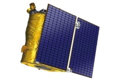
Satellite Remote Sensing
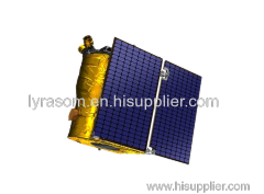
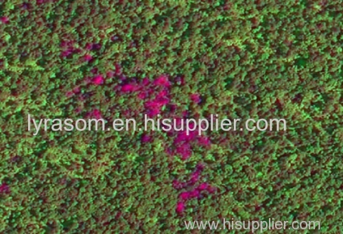
Remote sensing is a non-contact, long-distance detection technology. Relying on the unique global data set of JL1, using our big data intelligence tool to understand the changes taking place in the areas you are most concerned about, and help you make decisions faster and better.
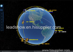
REMOTE SENSING SATELLITE SYSTEMS-DETECTING THE EARTH
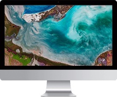
satellite remote sensing
What is Remote Sensing
optical remote sensing satellite is a comprehensive earth observation technology developed in the 1960s. It generally refers to all non-contact long-distance detection, including detection of electromagnetic fields, force fields and mechanical waves (sound waves and seismic waves).
satellite remote sensing data
What is a Remote Sensing System
The remote sensing system mainly includes remote sensing information source, remote sensing information acquisition, remote sensing information processing and remote sensing information application.
EXPLORE REMOTE SENSING SATELLITE MARKETS
high resolution remote sensing satellites list
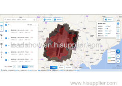
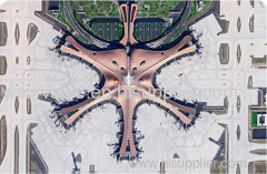
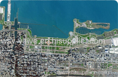
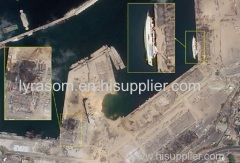
Urban Planning
The application of high-resolution remote sensing data to urban planning analysis is one of the main aspects of remote sensing applications, such as:
Dynamic monitoring of urban construction
Extraction of urban road network
Urban expansion monitoring
Urban environmental monitoring and assessment
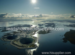
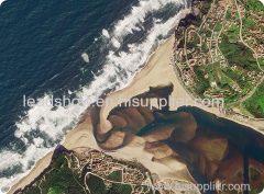
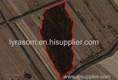
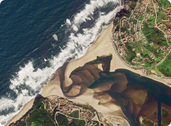
remote sensing in environment
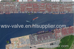
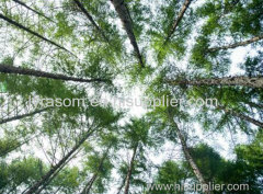
Environment
Remote sensing image has always been a powerful tool for environmental monitoring. Some of the feasible applications are:
Environmental impact assessment for a wide range of projects (natural resources exploitation, infrastructure development, etc)
River/Lake water bodies monitoring
Desertification processes monitoring and mitigation activities
Erosive processes analysis, restoration techniques planning and implementation
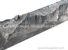
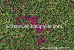
agriculture satellite data
Agriculture
There is able to provide data for monitoring, mapping and deriving biophysical parameters and state of agricultural lands. Some of the possible applications are:
Crop spatial distribution
Crop condition monitoring
Agricultural reservation supervision
Agricultural disaster monitoring
Chang Guang Satellite Technology Co., Ltd. is a satellite data companies, we provide satellite china, remote sensing satellite, satellite based remote sensing, aerial satellite services, etc. For more information about types of remote sensing satellites and satellite remote sensing technology, please feel free to contact us!
Related Search
Find more related products in following catalogs on Hisupplier.com
Company Info
Chang Guang Satellite Technology Co., Ltd. [China (Mainland)]
Business Type:Manufacturer
City: Changchun
Province/State: Jilin
Country/Region: China (Mainland)